Getty Images
This story was originally published by Undark and appears here as part of the Climate Desk collaboration.
A 30-meter, Komelon-branded measuring tape, a pencil, and a yellow paper form are all Hallsteinn Haraldsson carries with him when he travels to the Snaefellsnes Peninsula in western Iceland. But unfurling the measuring tape before me at his home in Mosfellsbaer, a town just outside of Reykjavik, he says it is a significant upgrade from the piece of marked rope he used to take with him.
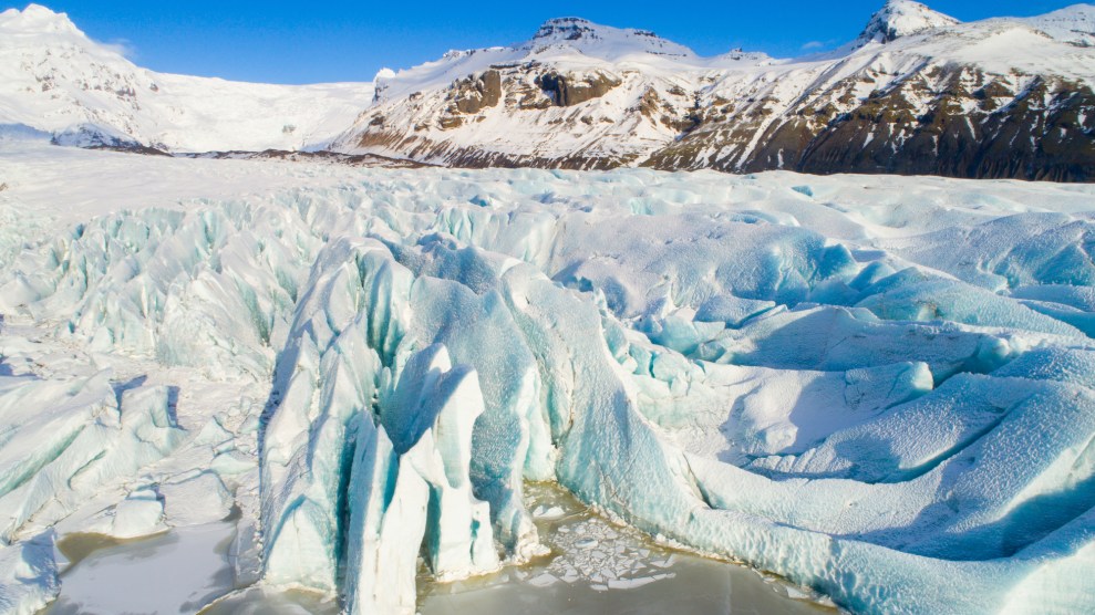
With 11 percent of the landmass covered in ice, rapidly ebbing glaciers are threatening to reshape Iceland’s landscape, and Haraldsson, 74, is part of a contingent of volunteer glacier monitors who are at the frontlines of tracking the retreat. Every autumn, Haraldsson, often accompanied by his wife and son, sets off on foot to measure the changes in his assigned glacier.
Their rudimentary tools are a far cry from the satellites and time-lapse photography deployed around the world in recent decades to track ice loss, and lately there’s been talk of disbanding this nearly century-old, low-tech network of monitors. But this sort of ground-truthing work has more than one purpose: With Iceland’s glaciers at their melting point, these men and women—farmers, schoolchildren, a plastic surgeon, even a Supreme Court judge—serve not only as the glaciers’ guardians, but also their messengers.
Today, some 35 volunteers monitor 64 measurement sites around the country. The numbers they collect are published in the Icelandic scientific journal Jokull, and submitted to the World Glacier Monitoring Service database. Vacancies for glacier monitors are rare and highly sought-after, and many glaciers have been in the same family for generations, passed down to sons and daughters, like Haraldsson, when the journey becomes too arduous for their aging watchmen.
It’s very likely one of the longest-running examples of citizen climate science in the world. But in an age when precision glacier tracking can be conducted from afar, it remains unclear whether, or for how long, this sort of heirloom monitoring will continue into the future. It’s a question even some of the network’s own members have been asking.
As Haraldsson tells it, his father was raised in a modest yellow farmhouse on the Snaefellsnes Peninsula. As an adult, he spent his days tending his fields and teaching at the local school, and in his free time, he studied the geology of the region, walking miles through the lava beds that lay in the shadow of the crown gem of the region: Snaefellsjokull, a 700,000-year-old glacier-capped volcano.
It was a quiet life, unremarkable to those who passed through, until the arrival in 1932 of Jon Eythorsson—a young man who had recently returned to Iceland after studying meteorology, first in Oslo, and then in Bergen, Norway.
Eythorsson was now working for the Meteorological Office in Reykjavik, and in his spare time he had established the first program to monitor the growth and retreat of Iceland’s glaciers—but getting around the country to check up on them was troublesome and time-consuming. For the scientific record, every glacier needed to be measured in the same month, and travel was slow, often complicated by fierce, unpredictable storms. If his project was going to succeed, he needed new recruits, ideally farmers who need not travel far.
That, says Haraldsson, is how his family came to inherit Snaefellsjokull. At the time, there was no sense of scientific urgency to glacier monitoring; glaciers had always expanded and deflated naturally in modest increments. But that was decades ago. The world’s glaciers now serve as harbingers of human-caused climate change, providing powerful visual evidence of how people have changed the planet.
Inside Haraldsson’s home, portraits of Snaefellsjokull adorn the white walls in a way often reserved for close family members. Some are rendered in pastels and watercolor, while others are more abstract, etched in black and white. To Haraldsson, his wife, Jenny (who painted many of them), and their son, Haraldur, it’s the family glacier.
Haraldsson began accompanying his father on his hikes to the glacier around 1962. Back then, the journey to the terminus was 10 to 15 kilometers by foot through steep, rocky terrain. The glacier itself spanned some 11 square kilometers—tiny as glaciers go. When they arrived, they would pull a long piece of thin rope with meter marks taut to measure the distance between the last icy bit and a metal rod, jotting down the observations they would send to the Society. When his father passed away 14 years later, Haraldsson took over the task full time.
From 1975 to 1995, the glacier actually advanced 270 meters, according to Haraldsson’s records. Such findings weren’t uncommon during that period: In the 1930s, many of the country’s glaciers had retreated significantly due to an unusually warm climate, but beginning in 1970, they advanced once more until human-caused climate change beat them back again.
Eventually his wife, and then his son, joined him in his annual glacial pilgrimage. By then a road had been built, passing within one meter of the glacier. From 1995 to 2017, their records suggest that Snaefellsjokull retreated 354 meters—a net loss of 84 meters from its position in 1975.
Most local people are upset to see the glacier disappearing, Haraldsson says. Everyone on the peninsula uses the glacier as their key landmark; in casual conversation, distance is defined by how far away something is from Snaefellsjokull. Others describe feeling a supernatural pull towards it. Perhaps Jules Verne felt the same: Snaefellsjokull served as the setting for his book “Journey to the Center of the Earth.”
When the glacier began its retreat in the 1990s, the family thought of it as a natural fluctuation. But since then, almost all of Iceland’s monitored glaciers have entered a state of decline. Now, they understand, their glacier is disappearing because of global warming. In 2016, scientists announced they expected Snaefellsjokull to vanish entirely by the end of the century.
Most data contained within the World Glacier Monitoring Service database, which includes more than 100,000 glaciers worldwide, has been created via aerial photograph comparisons. Each glacier inventory includes the location of the glacier, length, orientation, and elevation. “Entries are based on a single observation in time,” reads the WGMS website—a snapshot of a glacier in a particular moment. About half of all glaciers in the authoritative database are measured via a comparison of aerial photographs from year to year and maps.
In 2005, the WGMS and the National Snow and Ice Data Center launched the Global Land Ice Measurements from Space program. Rather than rely solely on photographs and in-person observations, glacier inventories can now be collected via a remote sensing instrument on NASA’s Terra satellite. The benefits of such increasingly sophisticated remote monitoring are substantial in terms efficiency. But if even aerial photography is going the way of the dinosaurs, what’s to become of Iceland’s glacier monitors?
It’s something that even Jon Eythorsson’s granddaughter, Kristjana Eythorsdottir, thinks about. She was only 10 years old when the elder Eythorsson, who formally established the Iceland Glaciological Society in 1950, passed away, but she followed his vocation and today works at the Iceland Meteorological Office. Her grey hair is shorn into a spiky pixie cut, and her hiking pants and running shoes suggest she’s ready to set out into the field at a moment’s notice.
“The [Glaciological] Society has a lot of written songs and texts,” she says, recalling the impact her grandfather’s volunteer network had on her life. “One saying goes that my grandfather loved the glaciers so much they were shrinking.”
When traveling together to examine the glaciers, the society’s members and scientists would sing songs written by Sigurdur Thorarinsson, an Icelandic geologist, volcanologist, glaciologist—and lyricist. They would write new ones, too; sometime before 1970, the Society published a book of glacier songs.
Since 2000, Eythorsdottir has been monitoring a terminus at Langjokull, a large glacier in the south of Iceland 100 times the size of Snaefellsjokull. (She didn’t inherit her glacier, but rather applied when one became available.) Each September, she sets out on the roughly five-hour round-trip hike to the glacier with her husband. “There is a river that goes here,” she says, tracing its path carefully on a map. “It’s kind of a bad smelling, geothermal river—the white-tempered river. We have to take our clothes off, or put on waders,” to get across.
Unlike Haraldsson, Eythorsdottir is using more modern technology. “We used to use measuring tape, but now we are tracking with GPS,” she says. “There are more possibilities to represent the data…but I think we will always go there anyway until it’s gone.”Sometimes they’ll look for different routes, passing through grazing sheep and their herders. The landscape is ever-changing. Already, the glacier has retreated more than 500 meters.
Whenever he runs into friends, Hallsteinn Haraldsson, the keeper of Snaefellsjokull, says they first they ask how he and his family is doing. And then, he says, they ask, “How is the glacier?”
It’s a question that was intimately familiar to all of Iceland’s volunteer glacier monitors as they gathered in 2016 at the natural sciences building at the University of Iceland in Reykjavik. Most had never met each other before, and they were there to discuss how the glaciers were changing and what tools would be best to measure the glacier fronts moving forward—mainly whether or not volunteers should increase their use of handheld GPS devices over reference points and measuring tapes.
“There’s been [internal] discussion as to whether we should keep doing this or not since it can now be done with remote sensing,” says Bergur Einarsson, a glacial hydrologist who recently took over management of the network from geologist Oddur Sigurdsson. Though some might see the crude nature of pen and paper measurements as a hindrance, Einarsson argues it’s actually an asset. “One of the strengths is that these measurements have not evolved. They’re done more or less in the same way they were done in the 1930s.”
That means that while scientists can now use remote sensing to gather precise images and coordinates, that record is much shorter and often lacks the same specificity as ground-level measurements. Moreover, complex technological projects require significant funding that often comes with a sunset clause: Time-lapse photography and remote sensors aren’t nearly as cheap—or as dependable—as a few dozen volunteers armed with measuring tapes.
(The strength of Iceland’s program was underscored last year when scientists from around the globe met at the American Geophysical Union in Washington, D.C., to discuss the fate of NASA’s Terra satellite. After 18 years in orbit, the satellite was beginning to run low on fuel—jeopardizing the scientific record.)
But for Einarsson, there’s an even bigger reason to keep it going—one that the Haraldssons and Eythorsdottir and some 33 other volunteer glacier monitors would likely share. “People are going out there, going to the glacier front, [where] they see the changes,” he says. “Then they are going back into society and they are almost like ambassadors of climate change, infiltrating information into different branches of society.”
“It is very important to engage with people in some way,” his predecessor Sigurdsson says, “and keep them interested in their surroundings.”
