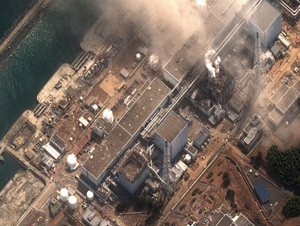
A map of radiation levels in Japan released by the US Department of Energy on Tuesday evening indicates that potentially dangerous levels of radioactive contamination have spread beyond the 13-mile evacuation zone surrounding the Fukushima Daiichi nuclear plant. The data is sure to further undermine confidence in Japan’s response to the disaster. US authorities have recommended that Americans stay at least 50 miles from the Fukushima Daiichi plant. Here’s the map, which was generated from the DOE’s Aerial Monitoring System and ground sensors:
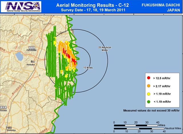 Spread of radiation from the Fukushima Daiichi nuclear plant
To put these numbers in context, a typical chest X-ray produces 10 mRem. US EPA guidelines require government intervention if the public is exposed to more than 1000 mRem over four days. People near Fukushima could be exposed to that amount of radiation at least every 3.3 days in the red zone and anywhere from there to every 19 days in the orange zone above. Of course, it’s unclear from the chart to what degree radiation levels in the area fluctuate over time. “Measurements show an area of greater radiation extending northwest from the accident,” a DOE backgrounder notes, adding with dry understatement: “This area may be of interest to public safety officials and responders.”

