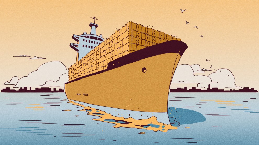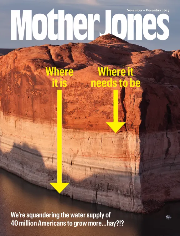
Water is life. It’s also big business. In our November + December 2023 issue, Mother Jones dives into the West’s deepening water crisis—and the forces behind it, from historic drought to short-sighted policies to corrupt lawmakers and the special interests they serve. Read the full package here.
If you draw it on a map, the Colorado River has the shape of a tree, with its trunk rooted in the Sea of Cortez and the branches reaching into the mountaintops of Wyoming, Utah, Colorado, New Mexico, and Arizona. Botanists call the shape of a tree a habit. It is a common form in nature, like an artery branching to capillaries or nerves reaching to fingertips. But there’s always another part that isn’t shown, a looping back to start over. The water runs down the mountains to the ocean that pumps it back to the mountains by way of clouds. The shape is really a circle. The cloud part is just hard to draw on a map.
If I’m being honest, the cloud part is a pretty weak effort, because the Colorado River begins and ends in a desert, a place of little precipitation. The clouds come laden from the Pacific Ocean but expend much of their water as they cross the Sierras and Cascades. By the time they get to the Colorado Plateau and the Rockies they have little water left to give. The Colorado River Basin is a watershed that covers a big area, roughly the size of Texas. The Columbia River watershed is about as large but carries 12 times as much water. The Mississippi watershed is five times larger than the Colorado’s but carries 26 times as much water.
So we should admit and accept, up front, that the Colorado never was and never will be a mighty river system, and that it is climate-challenged and prone to drought. We never should have asked it for so much. We invaded it like cancer, turning water into property. I wish it wasn’t so.
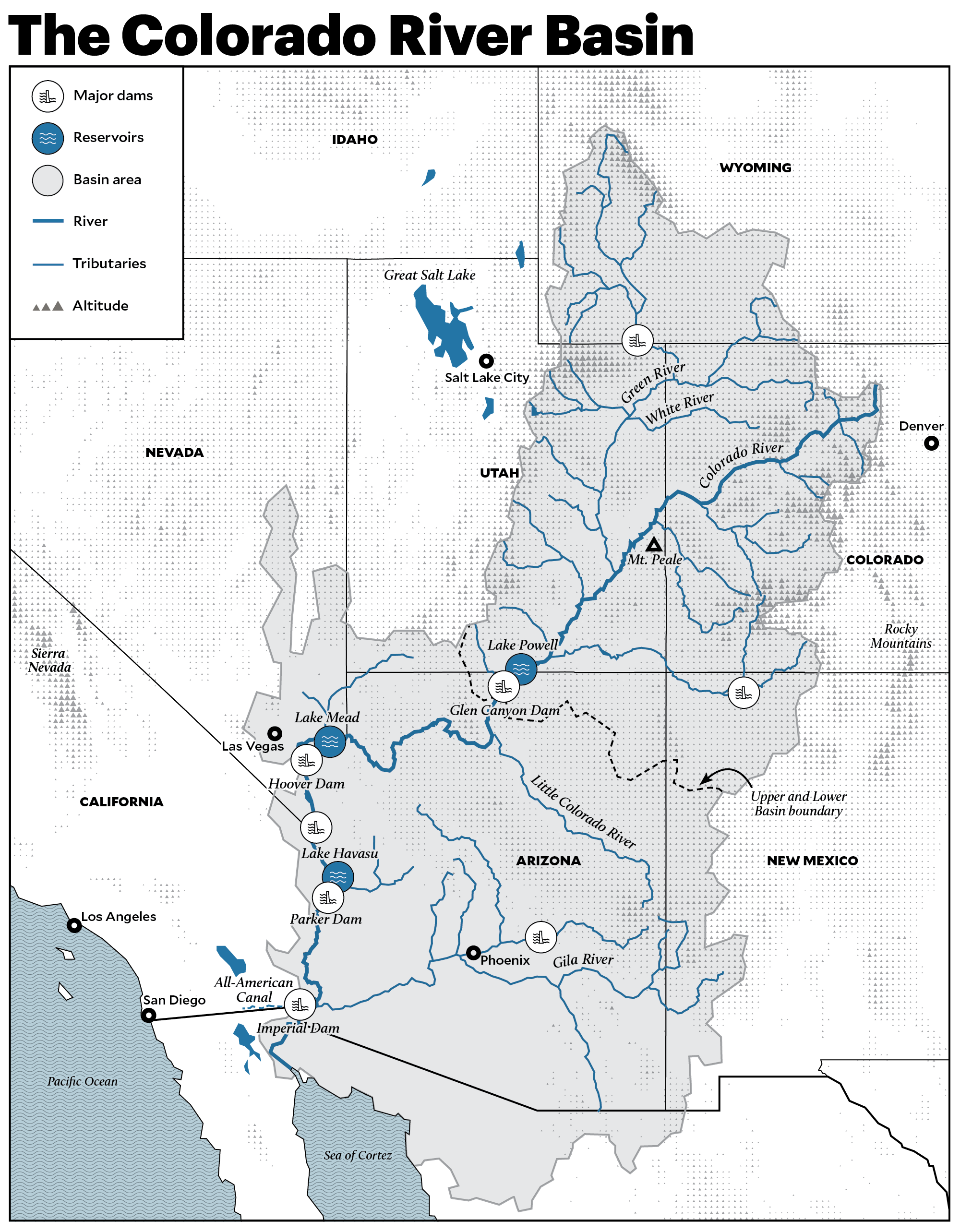
Most of the water in the river system—some 90 percent—falls as rain and snow in the mountains of the Upper Basin. To go back to the shape of a tree, the Lower Basin of the Colorado is the trunk, and the Upper Basin is the branches. Snowmelt from the upper branches in rural Colorado, Wyoming, and Utah runs downstream to supply the Lower Basin and the cities of Los Angeles, San Diego, Phoenix, and Las Vegas. Because the river—the whole watershed or whole tree—is so prone to drought, we built the country’s two largest reservoirs, Lake Mead and Lake Powell, near the top of the trunk, below the branches, to ensure the West’s cities and farms don’t run out of water.
The last time these two reservoirs were at full capacity was in the summer of 2000. In 2022, after 22 years of drought, both reservoirs were at about one-quarter of capacity. If that rate of decline were to continue, they’d both be empty in six years. The deluges of last winter bought us some time. But they don’t change the fact that the Colorado River system is in dire straits. If the waterline drops below the dams’ intake ports, their electromagnetic dynamos, which can generate up to 3.4 gigawatts, will no longer be able to bring energy to 1.6 million people. After that comes the level called “dead pool,” where the water drops below the reservoirs’ outlet ports and can no longer flow through to the river’s lower stretches.
Dead pool on Mead and Powell could mean people in Los Angeles, San Diego, Phoenix, and Las Vegas would not be able to wash their dishes or flush their toilets or get a drink of water from their hoses. These city-states could collapse. This is why people are freaking out about the Colorado going dry.
The problem at hand is clear: Somehow we need to find water to refill the reservoirs. We can’t control the amount of precipitation that falls within the Colorado River watershed, but we can control how we use the water that’s available. If we use less, there will be more to store in the reservoirs.
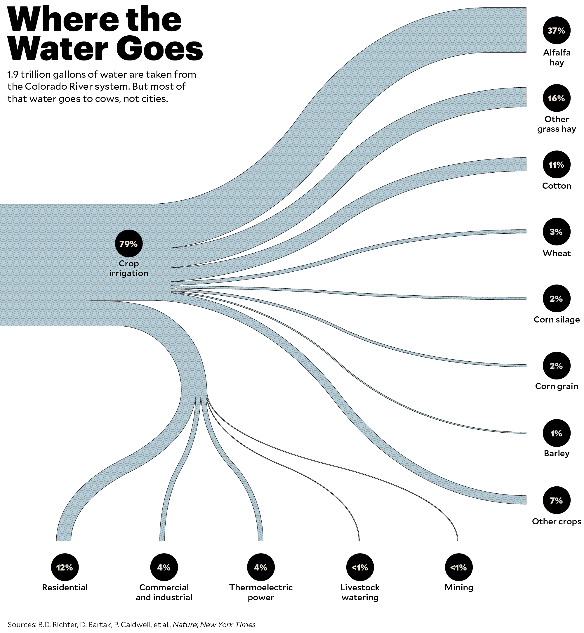
The river supplies 40 million people, the large majority living in cities, and you’d think this is where we could conserve a large amount of water. But it turns out that the cities—all the homes and lawns and golf courses and public parks and even the celebrity swimming pools—account for only 12 percent of what’s drawn from the river. Industry, such as factories and power plants and data centers, uses another 8 percent. And the rest, 79 percent of what we take from the river, goes to agriculture.
This seems like a lot of water being used for farming, but it’s actually a normal percentage compared with other river systems around the world; it takes a lot of water to grow food. What’s not normal about the Colorado River, however, is that an enormous portion, as much as 70 percent, of the water devoted to agriculture goes to just two crops—alfalfa and grass—to make hay. When you do the math, this means that more than half the water siphoned from the Colorado River is used to grow food for beef and dairy cattle, as well as for some sheep and horses.
Most people are unaware of this fact. It gets mentioned in news stories from time to time, but it drops out of the conversation, which seems tied up in arguments about more efficient sprinklers and getting rid of golf courses.
We need to wake up, quickly. Using more than half the water we take out of the river to make hay is delusional. Colorado River Basin states produce only 15 percent of our nation’s supply of hay—and by market value, 17 percent of that is exported overseas, mainly to China, Japan, and Saudi Arabia.
So if we stopped using Colorado River water to grow hay, our country would suffer just a 15 percent loss in hay production, but there would be enough water in the river to refill the reservoirs even as we continue to provide water to the growing cities.
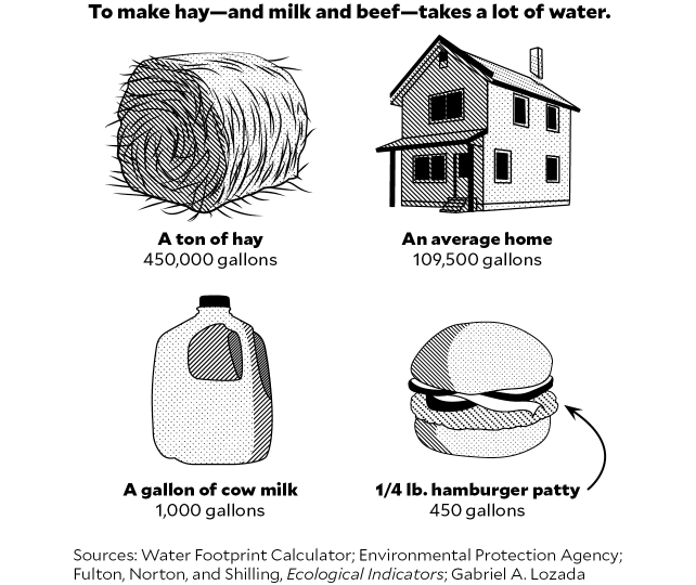
One ton of Colorado River hay is worth about $275. It takes as much water to grow that 1 ton of hay—450,000 gallons—as it does to supply four average homes with water for one year. It takes about 1,800 gallons to produce one pound of beef. This means that every time I eat a quarter-pounder, I’m also consuming 450 gallons of water. This is not an efficient use of a scarce resource. It’s like driving a semitrailer to the grocery store to buy a bag of chips.
To change this part of the system we first need to understand how things got this way, and to do this we must back up to when American settlement in the upper Colorado River Basin began. So let’s go back to the map, a topographic map showing lines of elevation, one drawn by Colorado River explorer John Wesley Powell in 1878. It shows much of the Upper Basin of the Colorado River, the limbs of our tree. Almost all of the water in the river system falls as snow from clouds as they pass over mountain ranges in the Upper Basin. These ranges are part of the greater Rocky Mountain system, and it’s common to think of them as forming one long wall that stands before the Great Plains, but they are actually more like a broad chain of islands, separate and isolated, floating in a vast ocean of sagebrush desert. In the winter, they become islands of snow.
Powell’s topographic map shows the land in the Upper Basin he believed could be inhabited by settlers who were packing their bags to go west and stake their claims. It’s a small amount of land, only 3 percent of the whole area, and it’s all surrounding the bases of the snow island mountains—precious greenbelts from 6,000 to 10,000 feet above sea level. Everything below 6,000 feet—97 percent of the map—is desert. Everything above 10,000 feet is high alpine or tundra. But in between there are grasslands.
It takes a lot of water for grass to grow, and the mountains provide a lot of water, snow that runs off in sheets every spring, creating lush meadows in broad valleys at the base of the slopes. Think of the scenery in a Marlboro advertisement—all the green grass below a snowcapped mountain. Powell said people could survive here in small, isolated communities, but warned there was not enough water coming off the mountains to build any kind of city, because cities need a lot of food and the amount of arable land was just too small.
I’m on the southern slope of the La Sal Mountains in southeastern Utah, 8,000 feet above sea level. It’s the middle of January and I’m standing atop 4 feet of snow, wearing sunglasses and cross-country skis. I came for the view and because I own some property near here. Two years ago, during Covid, I staked my claim on 10 acres, a place to build a refuge far from Salt Lake City, where I live. I’ve spent a lot of time since trying to understand the lay of the land.
Above me the slope rises quick and steep to the second-highest mountain in Utah, Mount Peale, at 12,700 feet above sea level. There’s maybe 10 feet of snow up there. Down below, the slope drops away slowly to the start of the desert floor at 6,000 feet above sea level. It’s dry down there, no snow on the ground. This slope factor is what causes the snow to fall. The clouds drift low across the desert floor from the west to the east, holding their vapor, but as they hit the slope of the mountain, they rise into cooler air that crystallizes the vapor, and it falls to the ground as snow. The higher the mountain, the cooler the air, the more snow that falls. All the snow islands are surrounded by a line, like a beach, where the white snow meets the purple sage of the desert.
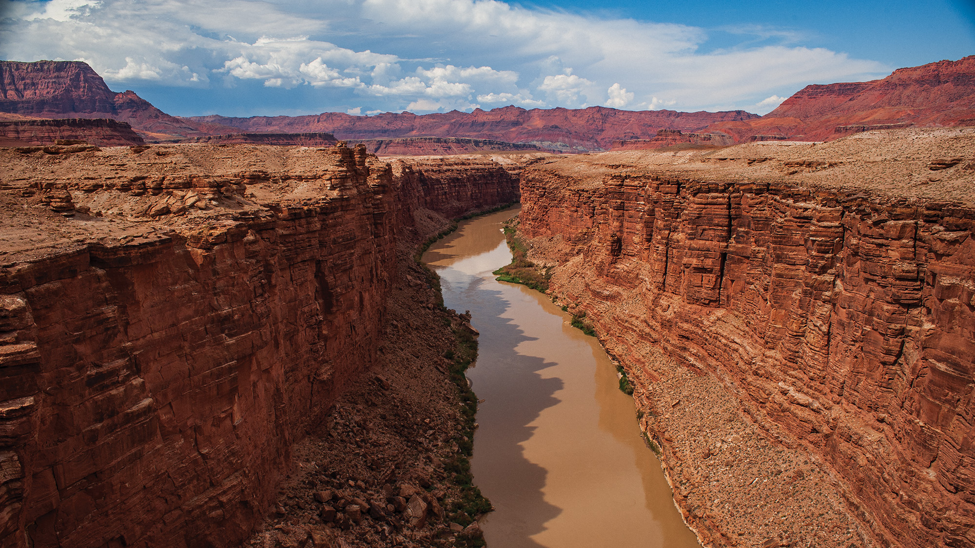
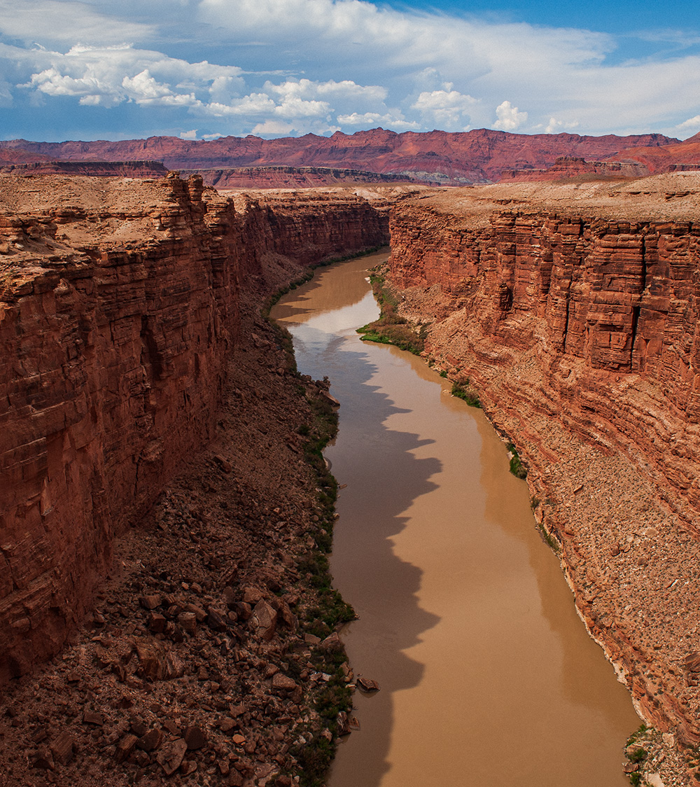
From this spot at 8,000 feet, I can see the beachlines of four separate snow islands, 40 to 100 miles away, across the desert ocean floor. To the east, the San Juan Mountains in Colorado. To the south, Ute Mountain and the Abajos. And to the west, the Henry Mountains, the last range in the continental United States to be mapped and named, in 1872. It took that long for white explorers to get there because the desert floor is not calm and flat like it appears to be from up here. It’s actually a maze of deep and narrow sandstone canyons cut by the water running off the mountains. It was very difficult terrain for explorers to cross on horseback, which is why John Wesley Powell explored by boating the Colorado.
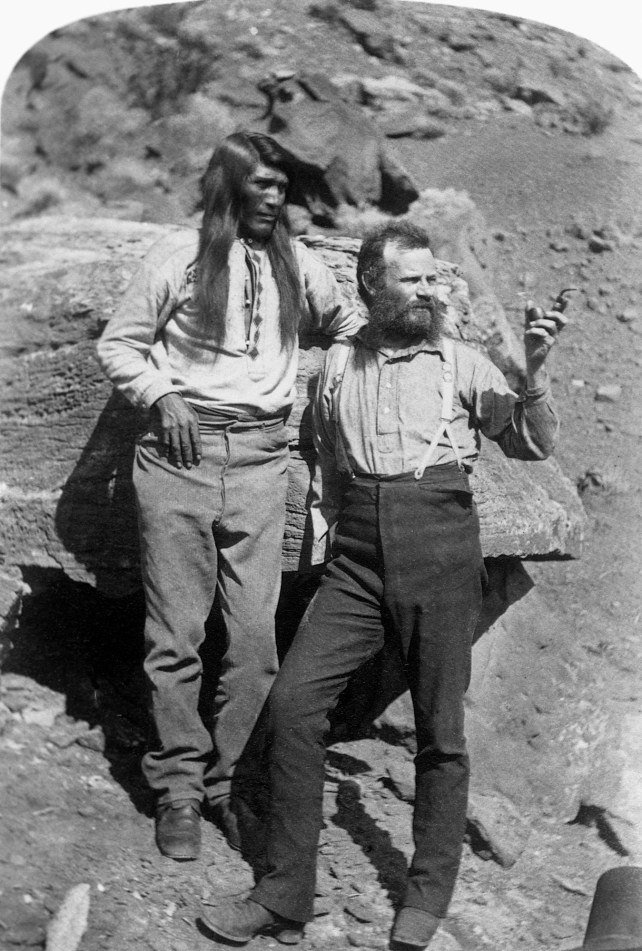
The noted geologist and explorer John Wesley Powell with a Native American man somewhere in the southwestern United States.
Corbis/Getty Images
Native peoples had been here for at least 13,000 years, living along the streams and rivers coming off the mountains, some moving from the low desert in winter to the high grasslands in summer. Obviously there were many different groups over time, but from what we can tell many held at least one belief in common—that the snow islands were the sacred homes of spiritual beings and that water was the life force behind all creation.
The white people, however, believed the snow islands and water were material things, property, given to them by their god to build his kingdom on Earth. Native Americans were given no role in that story, and they were rounded up—those still alive after plagues, famines, and wars—and forced to live on land with the least economic value; i.e., land with the least water.
My 10 acres used to be part of a cattle ranch that was once the home of Navajo, Pueblo, and Ute tribes. I’m not proud of this chain of title, and I can’t shake the feeling that I’m part of the problem, a symptom of the disease, which is growth for the sake of growth. I am a symptom of the cancer on the land.
Anyway, right below where I’m standing, at the base of Mount Peale, there’s a canal buried under all this snow. The canal is the real reason I came here, something I want you to see. It’s about 15 feet wide, 4 to 6 feet deep, and when it’s not covered by snow you can watch the stream of water running in the groove across the slope of the mountain.
This canal, called the La Sal Livestock Ditch, was built by men and horses more than a century ago. It diverts water—all the water—from La Sal Creek and carries it to fields of alfalfa and grass more than 10 miles away. There are canals like this surrounding all the snow islands. They all divert streams from their natural paths and riparian zones to flood-irrigate fields of alfalfa and grass often many miles away. Canals are the way—the only way—this kind of agriculture happens in the Upper Basin of the Colorado River.
John Wesley Powell tried to explain this in his Report on the Lands of the Arid Region of the United States, published in 1878. It begins with this statement:
The eastern portion of the United States is supplied with abundant rainfall for agricultural purposes, receiving the necessary amount from the evaporation of the Atlantic Ocean and the Gulf of Mexico; but westward the amount of aqueous precipitation diminishes in a general way until at last a region is reached where the climate is so arid that agriculture is not successful without irrigation.
People back east had heard of agriculture through irrigation, but they’d never actually done it because they didn’t need to. The climate back east is humid, with “abundant rainfall for agricultural purposes.” Powell’s report was a warning to prospective settlers who only knew this kind of environment. He said, essentially, “Don’t go west thinking it will be like anywhere you’ve ever been, unless you’ve been to Mongolia and seen the Gobi. It’s all an arid region where you’re going to have to dig canals to survive.”
Digging a canal is too much work for one man, or even a whole family. A canal requires the labor of a community over a long period of time. Powell suggested that settlers follow the social organization of the Mormon pioneers who had been surviving at the base of the mountains for 25 years before he arrived. They owned land as individuals, but cooperated under ecclesiastical control to build canals and manage the water.
It was all about grass and water. They grazed cattle and sheep on native grasslands up on the mountain and made hay on land below at the edge of the desert where the temperatures are warmer, permitting a longer growing season. They built their homes next to their fields, and they built canals to bring water to their fields, and they grew enough food to feed themselves and their animals over the long, cold, snowy winters. This was how white people could survive out here.
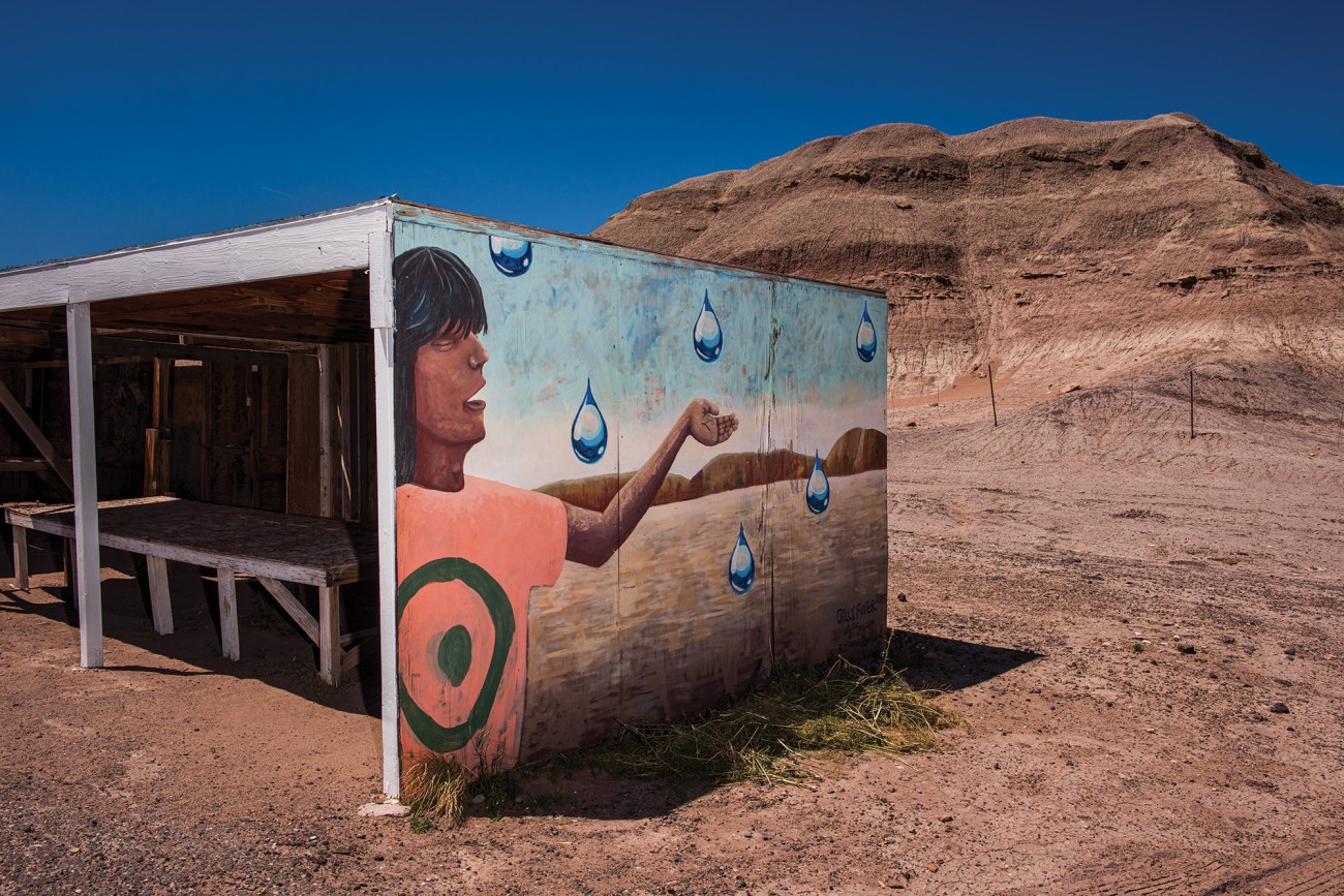
A hand painted mural by Billy Fefer on a vendor booth on the Navajo Nation off of Highway 89 south of Willow Springs.
Russel Albert Daniels
In order for the early pioneers to successfully farm in the Upper Basin of the Colorado, a new kind of water law needed to be written. Our water law came from British common law, which said that no one can own water because it’s like sunlight, res communes, common to all and property of none.
What could be owned, however, was a right to use water for reasonable purposes, under these conditions: 1) You had to own property next to a source of water, such as a spring, river, or lake; 2) You had to use the water on your property, such as for a mill or iron foundry; and 3) You couldn’t pollute it or use so much water as to deprive people downstream from their use of the water on their land. This is called riparian law, and it worked well enough in the British Isles and the eastern United States because both have humid climates where irrigation is unnecessary.
But in an arid climate water needs to be moved. So the new law got rid of the part about how water rights had to be linked to its natural source. Under the new law, distant landowners had a right to water from a stream, river, or lake if they could show that they would use it for beneficial purposes, such as mining or agriculture, in another location. Building canals was the way to exercise this right and to bring water to another location quite separate from its natural path.
The problem is that, when you separate water from its source by putting it in a canal, it becomes a commodity, like electricity in a wire or oil in a pipeline. Commodities can be bought and sold on the open market and are at risk of monopolization. Powell believed canals were absolutely necessary, but that there were risks involved:
The magnitude of the interests involved must not be overlooked. All the present and future agriculture of more than four-tenths of the area of the United States is dependent upon irrigation, and practically all values for agricultural industries inhere, not in the lands but in the water. Monopoly of land need not be feared. The question for legislators to solve is to devise some practical means by which water rights may be distributed among individual farmers and water monopolies prevented.
The solution they came up with was to sever the water rights from the land where the water comes from and give them to the land where it is used. Powell phrased it this way:
The right to use water should inhere in the land to be irrigated, and water rights should go with land titles.
But then there was the basic problem of there not being very much water to begin with. The earliest explorers and pioneers who came from the east to the Upper Basin knew right away, just by looking around, that the naturally irrigated land, the grassland beaches wrapping around the mountains, was scarce, and someday soon, with western expansion, there wouldn’t be enough of this land with water to go around.
So the new water law was written under the rule of first come, first served. The first people to build a canal diverting water from a stream would have the first appropriation of the water from the stream. The people who built the second canal would have the second appropriation, and so on down the line. When there wasn’t enough water in the stream for everybody, such as in times of drought, the people on the bottom of the list would be the first to lose their appropriation. This is why they called it the law of prior appropriation.
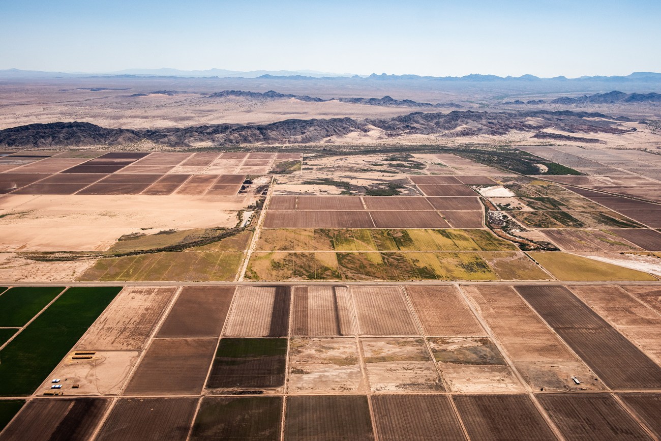
Colorado River irrigated farmland. Colorado River Indian Tribes agriculture land. CRIT rotates thousands of acres into and out of production each year as dictated by good land stewardship.
Under prior appropriation, each new water right would describe the location of the diversion and the amount of water to be diverted, as well as the precise location of the land where the water was to be used for a specific beneficial purpose, such as irrigation to produce hay. If you didn’t use your water, every year, for the described beneficial purpose, your right would be forfeited—“use it or lose it.” Furthermore, these rights would be ranked by the time of their appropriation. Prior appropriation laws were eventually adopted by all the states along the Colorado River.
In his Report on the Lands of the Arid Region, Powell described the coverage of grass in the mountains as “scant.” But Powell was a geologist, not a cattleman. There are many accounts from early settlers in the Upper Basin that describe lush meadows—“the country was a wave of grass” that grew “high enough to hide a saddle horse if his head was down feeding.”
Perhaps Powell was describing the grass on open slopes, and the settlers were talking about the grass in the riparian zones along streams that ran year-round. At the base of a mountain, on a gentle slope, a stream will meander, creating meadows with tall grass sending roots deep into the ground. These roots create something of a sponge, holding water and soil to the benefit of other plants and animals—flowers, shrubs, insects, birds, and mammals—including beavers. Beaver dams, like the grass, slowed the flow of water running off the mountain. Together, they ensured the snow islands were surrounded by lush meadow sponges that sat between 8,000 and 10,000 feet.
The grasslands were all open range, there for the taking, and the early settlers grazed these riparian areas like miners extracting veins of gold and silver. By 1870 there was a railroad running across the country, and cattle corporations based in New York, London, Texas, and Pittsburgh soon brought in more than 100,000 animals to feed on the grassland beaches wrapping the mountain islands, before corralling them back onto trains in the fall bound for slaughterhouses in Chicago and San Francisco. They boasted of annual profits of 40 percent, but after 10, maybe 20, years of overgrazing, the tall grass was gone, eaten down to bare rock, killing the roots, drying up the sponges, and the first floods ripped gutter arroyos straight through the meandering meadows, lowering the water table, creating places where only sagebrush and rabbitbrush would grow, turning grassland into desert. The veins of gold and silver were gone—and they will never come back.
By the turn of the last century the mountains in the Upper Basin had reached their limit for growth and development.
The 3 percent of land capable of supporting agriculture had been claimed and all available water rights appropriated. Much of the grass was gone, but ranching continued on a smaller scale. People kept moving west, settling in areas just outside the Colorado River Basin where the land was lower and flatter, making it easier to farm and more productive. The city of Denver (elevation 5,280 feet) grew up along the eastern slope of the Front Range. The city of Salt Lake (4,300 feet) prospered in the Wasatch valley. And down beyond the bottom of the river there was Los Angeles at the base of the Santa Susana Mountains. These places were part of the arid region described by Powell, but their nearby mountains provided enough water for farming and city life. At least in the beginning.
In 1890 the population of Denver was 107,000. By 1910 it had doubled to 213,000. Salt Lake City went from 45,000 to 93,000. Los Angeles boomed from 50,000 to 319,000. It was clear there wasn’t enough water in local streams and rivers to support this kind of growth, so the cities looked over their ridgelines to the Colorado River Basin, where there was still a lot of water running all the way to the Pacific Ocean. Under the law of prior appropriation, the water was there for the taking. All they had to do was build canals or tunnels to bring the water around or through the mountains.
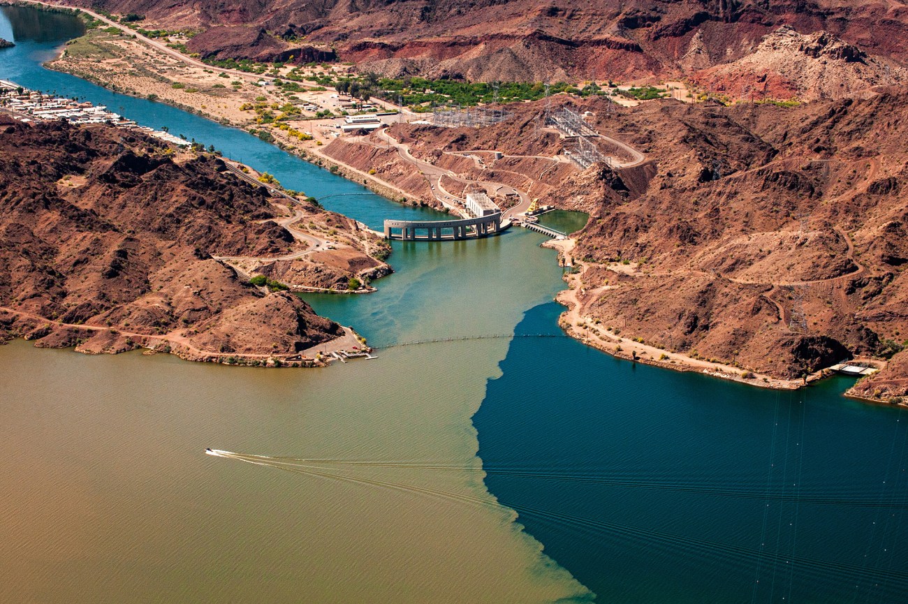
These projects were big and expensive, but the water was worth a lot more money once it was outside the basin. And so in 1902 the federal government created what became the Bureau of Reclamation to plan and oversee the construction of an immense system of canals, pipelines, and dams. It took billions of dollars and most of the 20th century to build a system to sustain the West’s growing population. Down where the Colorado River crosses into Mexico, near Yuma, Arizona, we built the Imperial Dam and the 81-mile-long All-American Canal to bring water to California’s Imperial Valley. Moving upstream, we built the Parker Dam, creating Lake Havasu with two aqueducts—one 242 miles long, the other 336 miles long—to bring water to Los Angeles and Phoenix. Farther north, we built the two largest dams in the United States—Hoover and Glen Canyon—to hold a four-year supply of water in Lake Mead and Lake Powell. Of the 40 million people the Colorado River supplies, about 20 percent don’t even live in its watershed. It’s an amazing system. Unfortunately, it’s now tapped out.
There’s a graph that shows two lines. One is the amount of water that flows through the Colorado River every year since 1920. The other shows the amount of that water consumed by humans every year since 1920. The line showing water supply stays level, averaging about 15 million acre-feet a year. (An acre-foot is 325,851 gallons, which is how much water it takes to cover an acre in 1 foot of water.) The line showing consumption starts at about 5 million acre-feet in 1920 but climbs steadily until it crosses the line showing supply around 2003. Ever since, we’ve been using more water than the river has to offer. We’ve been surviving by drawing down the reserves in the reservoirs and now the reservoirs are close to being empty. Which brings me back to where I started.
The reason why more than half the water we take from the Colorado River is used to grow hay is that the first water rights were appropriated for growing hay, and these rights still exist. The ranches and farms in the Upper and Lower basins have changed hands many times over, but the land titles and water rights have stayed tied together, with their order of priority maintained. So a ranch that was using 10,000 acre-feet of water to produce hay in the late 1800s is still using 10,000 acre-feet of water to produce hay today.
Hay prices go up and down depending on market forces and weather that can ruin years of planning and hard work. And it’s not a lucrative business. There’s just not a lot of profit in growing hay or raising cattle.
But farmers and ranchers don’t grow hay and raise cattle to make money—they do it in order to keep their land and water. Because if they don’t use their water to irrigate their hay fields, they lose their right to the water, and land in a desert is worthless without water. A cattle ranch is an investment.
If you can hold on to your ranch by just squeaking by, the value of your land and water just keeps going up and up and up. So, more than half the water we take from the Colorado River is being used to produce hay largely because growing hay used to be a matter of survival but is now more like a retirement account.
The quickest, most efficient way to put water in the reservoirs would be to amend Western water law, state by state, to allow hay producers to keep their water rights if they don’t use their water. Then they could lease their water at a profit to refill the reservoirs. If they are in the Upper Basin, they’d close their canals and let the water run its natural course to Lake Powell; if they are in the Lower Basin, they’d simply stop watering their fields and let the water stay in Lake Mead. Their water is worth more, much more, in the reservoirs than on their fields.
To a small degree, this is already happening. Agricultural users have been allowed to enter into water leases to protect the environment and improve recreational areas for decades. And Congress just passed a law allowing the Colorado River Indian Tribes, a federally recognized group whose reservation spans the river south of Lake Mead, to lease water to Arizona. (Only recently were tribes in the Colorado River Basin given any meaningful water rights, and even now, because little infrastucture was ever built on tribal lands, they tend to be rights on paper only.) And Utah recently passed a law allowing hay farmers to send their water downstream to help refill the Great Salt Lake, but so far few have taken the state up on it, citing fears that the water will just flow to other ranchers.
But, theoretically at least, we could refill Lake Mead and Lake Powell within 12 years by leasing water that is now being used to produce hay—about 3 million acre-feet a year. If we were to lease 3 million acre-feet of water at an average price of $400 an acre-foot—a typical rate in Lower Basin states—it would cost about $1.2 billion a year. This is a lot of money, but when you divide it by 40 million users, it’s only about $30 per person per year. This is a much better scenario than not being able to flush your toilet, or than having both reservoirs running dry.
I’m not saying we should do it. There would be downsides, negative consequences, for sure. Leased water is a commodity subject to supply and demand. In times of drought, like now, the price could skyrocket. In Utah, many water rights are held by collective irrigation and canal companies—a legacy of the Mormon communes of Powell’s time—and a majority of the shareholder farmers must sign off on any leases to the state. And large-scale water leasing could also mean the demise of the Western cowboy. A water lease essentially pays a rancher not to grow hay to raise cattle; that is, a water lease pays cowboys not to be cowboys. The only work a rancher has to do is open the diversion dam on his canal and let the water run downstream. The lease pays more than he can make by producing hay, beef, or dairy products, so why go through all that roping and wrangling? The money is already in the bank. Soon no one would be singing:
Whoopee ti yi yo, git along little dogies. It’s your misfortune and none of my own.
I have some good friends who would lose no love if the Western cowboy were to disappear. They believe cattle are bad for the environment. But I eat meat, and I like some cowboys more than I like some environmentalists. The cowboy is a big part of American culture, the romantic myth part, Rio Bravo, High Noon. I don’t even like horses very much, but I’d be lying if I said the cowboy way has been of no value in my life.
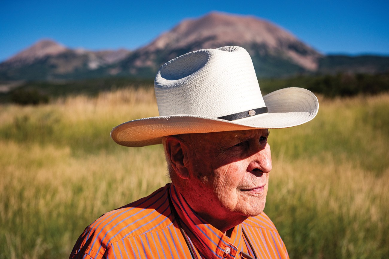
It’s time to talk to Hardy Redd, an actual rancher who’s lived here all his life. He’s 87 years old, son of a man who started ranching in the La Sal Mountains around the turn of the 20th century. Members of the extended Redd family now graze cattle across much of the southern slope of the La Sals, and they own the rights to a lot of water coming off the mountain, including most of the water in the La Sal Livestock Ditch, which goes to Hardy’s farm.
Hardy Redd
Hardy’s house is modest, if not frugal—not what I imagined as the home of a former state representative and the patriarch of one of the most successful ranching families in the Upper Basin. We sit in his office area in the living room, surrounded by books and under a wall plaque of a Mormon temple. I’m not a member of the LDS church and I probably voted for a different candidate in the last presidential election, but I felt at ease in Hardy’s house, perhaps because he seemed genuinely interested in what I had to say.
I ask him if he’s heard about the state’s new water leasing programs, and he says he hasn’t. So I explain the idea as best I can, then ask him what he thinks is a fair price per acre-foot of his water, and he avoids the question. Ranchers usually don’t want to talk about how many cattle or how much water they have. It’s sort of like asking someone how much money they have in the bank. So I ask him if he’s worried about the ranching way of life coming to an end.
“I have mixed feelings,” he says. “And I need to be careful how I talk about this because I’ll offend my neighbors who feel deeply that the cowboy way should not be done away with. They see it like, ‘A man who sells out is selling his soul.’ And I recognize it.”
“Would you feel like that?” I ask.
“There’s something about it getting in your blood,” he says. “There’s this nostalgia—‘This is the only lifestyle or business on earth.’ It’s kind of chauvinistic—‘We’re No. 1.’ I see a lot of this in livestock people, and I don’t know whether they’re afraid they can’t do anything else, or that there’s glamour or romance in it in the eyes of the world. Some of it is really genuine—‘My dad, granddad, and great-granddad came here and worked their heart out to get this place in shape, and I’m not going to let them down.’ There’s that kind of pride. And pride is a good thing, except when it’s not.”
“My dad was enlightened on this. He told us, ‘You don’t have to be a rancher just because I was a rancher.’ He could see that life was going to get more complicated and farm labor was going to be harder to acquire. He said, ‘Ranching is not a lucrative business. You have a big investment in land and livestock, but the returns are usually lower than other businesses. You can have a good life, if you’re careful and prudent, if that’s what you want to do. But there are other investments that are far more valuable.”
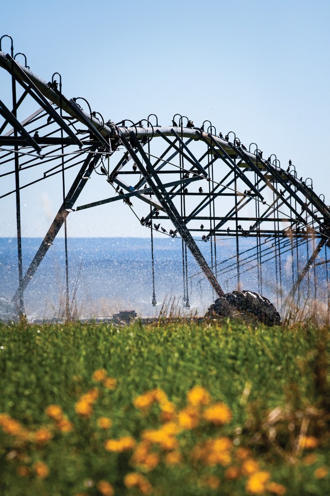
Pivot irrigation (left) waters alfalfa fields on the ranch of Hardy Redd (right).
Russel Albert Daniels
“So you’re a cowboy,” I say, “but you’re not attached to it. You’re not afraid to see it go away?”
“Maybe,” he says. “A horse and buggy is good to see on the screen and romantic and life was supposedly simpler. But horses ran away and killed people. People don’t remember that. And so I’m nervous about people standing in the way of progress. I think a growing dynamic economy that enriches more people to a greater extent is better than hanging on to the past, or even the present. I don’t want my freedom to innovate, or other people’s freedom to innovate, to be restricted.”
“Some things are inevitable,” he says. “I hate to say it, and it sounds really bad, but economics really rules a lot of our lives. It’s kind of inevitable that this land has a higher use. Just like the land you bought up there. I don’t like the subdivision, but one of my mantras is property rights are sacred. People have the right to do what they want.”
“But,” he added, “one thing I found in life, and also by serving in the legislature, is you never do just one thing. There’s always unexpected consequences that come up, things you don’t anticipate. You ever see a movie called Chinatown?”
Last winter we had record snowfalls, and when I ski along Hardy’s canal in the middle of April it is full of water, almost overflowing, like the levees are going to break. Everybody is happy because come summer there will be enough water to go around, and the reservoirs will go up instead of down. This buys us some time, at least a little bit.
The Biden administration has pledged $4 billion from the 2022 Inflation Reduction Act for “conservation efforts in the Colorado River Basin and other areas experiencing similar levels of drought.” Much of this money will go to rebuilding existing infrastructure and improving efficiencies of canals and irrigation systems.
A little over a billion of that money will be used to buy water leases in the Lower Basin. But the Upper Basin has been allocated only $125 million for its leasing program, and it seems to be failing. States in the Upper Basin, particularly Colorado, are not pushing leasing, perhaps because they have yet to figure out how to ensure the water ends up in Lake Powell. The farmers and ranchers are not signing up. Even if they can make more money from leasing water than from growing hay, they are cautious about changing their business models and their way of life. Leasing their water would mean getting rid of some of their animals and firing ranch hands. Communities would be affected by the loss of jobs. Schools might close. And what are they going to do when they get up in the morning? What will they be if not ranchers?
Parker Dam and the confluence of the Bill Williams River and Lake Havasu with the Colorado River.
This past May, the Lower Basin states—Arizona, Nevada, and California—agreed on an emergency stopgap measure to conserve 3 million acre-feet over the next three years, but this will not be enough to make a real difference. Meanwhile, the Upper Basin states—Utah, Colorado, Wyoming, and New Mexico—have no plan for conserving 2 million to 4 million acre-feet of water, as they have been urged by the Bureau of Reclamation to do.
Four billion dollars in the IRA isn’t going to be enough to solve the problem. There are too many people living in the desert and there will be more tomorrow and the next day, and snow clouds can’t be bought. But there is enough water in the Colorado River, even under present drought conditions, to support 40 million people if we stop using more than half of what we take from it to grow food for livestock, though apparently we can’t figure out how to do that, or even if we should.
At the end of June, I’m standing at the barbed wire fence that separates my land from US Forest Service property, watching some cows and calves graze on new grass and flowers. Behind them is Mount Peale, still holding snow in the couloirs. The sky is dark blue and there’s a cloud sitting over the peak like a hat. It’s a beautiful, idyllic scene. The baby cows running around in the meadow seem like they belong here more than I do, but the writing is on the wall. They—or at least their food—are going to have to go to another part of the country because humans in Salt Lake, Phoenix, San Diego, and Los Angeles need their water. It’s not happening yet, but it seems inevitable. The cities need water in order to exist, and the snow islands of the Upper Basin are the easiest, cheapest place to get it. I come from one of those cities, and I’m working on building a house out here because I know my city is doomed. I want to live here and go back to when the mountain was inhabited by spiritual beings and water was the life force behind all creation.