A sampling of road claims around the West:
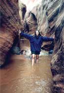
North Escalante Canyons, Utah
To get to this narrow, water-filled gulch, listed as a “road” on Garfield County maps, you would have to drive over a waterfall and then somehow get a vehicle through curving sandstone walls that stand just five feet apart.
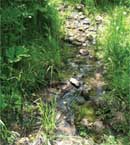
Barking Dog Trail, Colorado
This trickle of a stream is less than a foot wide in places. The Mile-Hi Jeep Club has formed a Barking Dog Shovel Brigade to widen what it says is an RS 2477 road and has torn down Private Property signs because they “harm trees.”
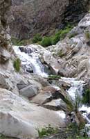
Surprise Canyon, California
This trail in Death Valley National Park is so steep jeepers used to drill holes in the rock and winch their rigs up seven waterfalls to get to the top. It’s been off-limits to vehicles since 2001, but off-road groups have filed an RS 2477 claim to get it reopened.
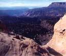
Route to Trail Hollow, Utah
Gravity is your worst enemy at “Harveys Fear,” shown as part of a road on Kane County maps. The Wilderness Society calls this plateau, home to a forest of 1,000-year-old junipers, “one of the least accessible areas in the country.”
More RS2477 road claims around the West:
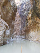
Muddy Creek, San Rafael Swell, Utah
This popular swift-moving creek is called a highway, and it is: for summer kayakers. The Muddy Creek highway flows up to 500 cubic feet per second and provides habitat to wild horses and mountain lions.
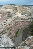
Yampa River Canyon, Colorado
RS 2477 advocates argue that this gently flowing canyon river, a habitat for threatened bald eagles and peregrine falcons, was “built by Indians” in the 1800s. Apparently, Native Americans used the frozen river as a cattle trail in winters, which spells r-o-a-d for some.

Arch Canyon, Utah
This popular hiking area near the Abajo Mountains is defined by its magnificent arches, fins, and spires, as well as its abundant Anasazi ruins and rock art. Off-road vehicle users motor through delicate riparian zones leading the Navajo and Hopi tribes to ask the BLM to assess and preserve the area’s unique heritage. The RS 2477 trail crosses one stream 60 times in 8.5 miles.

Dry Blue Road, Gila National Forest, New Mexico
The Dry Blue Road was completely destroyed by a 1983 flooding of the Dry Blue Creek that runs along it. The following year, the road was closed by the Forest Service to protect the creek, a rare habitat for the native loach minnow. Catron County is trying to reopen the road to provide emergency vehicle access to a 48-acre subdivision, despite the fact that all the homeowners said they use a faster, more reliable road for emergency access and enjoy the peace and solitude.

Last Chance Canyon, Death Valley National Park, California
Despite the temperatures, which can reach 130 degrees, RS2477 advocates want this “road” expanded into a two-lane highway up the nearly vertical wall of Last Chance Canyon. By Inyo County’s own admission, the road historically was used as a horse and foot-path. The Canyon was declared “roadless” in 1979.
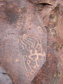
Greenwater Canyon, Death Valley National Park, California
Greenwater Canyon is unique because of 200-some petroglyphs left by Native Americans. Off-roaders cite the ancient drawings as evidence that the region was an Indian trail to support RS 2477 claims. The petroglyphs are now about 10-feet above the sandy canyon floor due to both water and vehicle erosion.
Got some other examples? Add to the list in the comments section below.

