NOAA
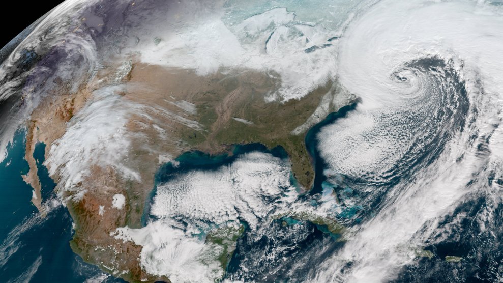
The bomb cyclone is here. After bringing snow to Florida, and freezing fountains in Georgia, the storm made its way up the east coast bringing subzero temperatures, blizzard conditions, hurricane-force winds, and yes, even flooding.
Here’s what the powerful storm looks like from space.
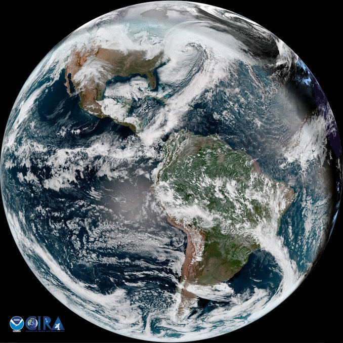
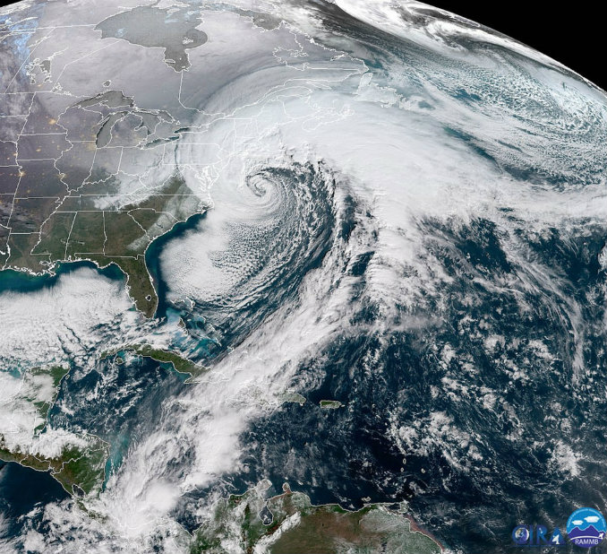
Here on Earth, areas affected by the storm—especially New York and New England—could expect rates of 3 to 5 inches of snow per hour accompanied by 50 to 80 mile-per-hour wind gusts.
A popular summer tourist spot was turned into a winter hellscape as the storm lashed at the Maryland coast.
You’re not used to seeing Ocean City, Maryland look like this! @CoriC_FOX5DC https://t.co/7sXEnpQWWN pic.twitter.com/KWo8e3Nf4p
— FOX 5 DC (@fox5dc) January 4, 2018
New York saw white-out conditions as the storm approached.
WHITE OUT in Riverhead/Suffolk County, NY with this band dumping at 1-2"/hour with wind gusts 40+ MPH. Up to a foot of #snow followed by record sub-zero cold this weekend. #Grayson #frozenAmerica pic.twitter.com/B2Got7JCl0
— Mike Seidel (@mikeseidel) January 4, 2018
Because the storm is coinciding with high tide, eastern Massachusetts also must cope with severe flooding.
Severe storm surge has started to affect the New England coast as high tide starts to roll in during the winter "bomb cyclone" https://t.co/6vyqMy8LBC pic.twitter.com/Krii7hZv5Q
— CBS Evening News (@CBSEveningNews) January 4, 2018
Flooding in Scituate, MA! (via Jill Pelo) pic.twitter.com/T9GTzhokls
— AndreaWBZ (@AndreaWBZ) January 4, 2018
The storm is expected to pass by Thursday night but will be followed by record-shattering cold weather. According to the Washington Post, large swaths of the country can expect temperatures 20 to 40 degrees colder than normal. Most places in the Northeast and Mid-Atlantic will likely break records this weekend with high temperatures in the single digits and teens. Winter haters will have to wait until early next week to begin enjoying slightly warmer temps—but remember, it’s only January.

